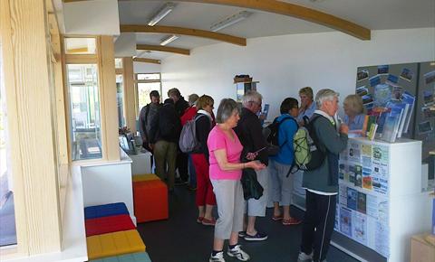
Visitor Information Point
Heritage/Visitor Centre
St Marys
Isle Of Scilly
Isle Of Scilly
TR21 0JJ
Tel: 01720 424031

The Visitor Information Point is based in the Shelter Shelter on Porthcressa Bank, St Marys. It provides all sorts of information to ensure you get the most out of your stay on Scilly. It operates a late availabilty vacancy service over the telephone, by post or email. There is also have a stock of maps, leaflets & guide books and it publishes a weekly 'What's On' information sheet.
Further Information
Opening Times
| Open All Year |
|---|
* Summer Opening Hours: 9.00-6.30 Mon to Sat, 9-2 Sundays and Bank Holidays.
Winter Opening Hours: 10-2pm Monday- Friday
What's Nearby
-
Scilly Walks
Scilly Walks offers guided walks, boat trips, slide shows and short break holidays to introduce you...
0.11 miles away -
Hugh House
Overlooking the sandy isthmus of Hugh Town, the current offices of the Duchy of Cornwall were built...
0.15 miles away -
Lifeboat Station
Defining the harbour is the lifeboat station, inside you will find paintings, models and accounts...
0.24 miles away -
Buzza Tower
Previously called King Edward's Tower this well know landmark has been maintained since 1912 as a...
0.26 miles away
-
Harry's Walls
An unfinished fort in the care of English Heritage. Though named Harry's Walls, it was begun in...
0.43 miles away -
Garrison Walls
Fortified walls encircling the headland west of Hugh Town, begun about 1588 and added to during the...
0.44 miles away -
Lower Moors Nature Trail
Fantastic for local and migrant bird life. Lower Moors exhibits a wide range of wetland habitats;...
0.52 miles away -
Glandore Gallery
Glandore Gallery is a beachside studio/shop featuring work by Stephen Morris and Nan Heath,...
0.67 miles away -
Carreg Dhu Community Garden
A 1.5 acre sub tropical garden which has been formed on several levels from an old disused ram pit...
0.96 miles away -
Telegraph Tower
This circular granite building was erected on the highest point of the Islands as a gun and...
1.13 miles away -
Bant's Carn Burial Chamber and Halangy Down Ancient Village
Set on a hill above the site of the ancient Iron Age village, lies this Bronze Age burial mound,...
1.24 miles away -
Higher Moors Nature Trail
This site exhibits a wide diversity of habitats with several rare and notable plant species. The...
1.27 miles away -
Old Man of Gugh
This leaning menhir, 2.4 metres high, is a prominent feature on the skyline. George Bonsor dug...
1.56 miles away -
Bar Point
Between McFarland's Down and the Innisidgen Bronze Age Tombs, you will find Bar Point, one of St....
1.7 miles away -
Pelistry
Ask anyone who lives on St. Mary's why they love Pelistry and the same reasons pop up. Pelistry Bay...
1.79 miles away -
St. Agnes Lighthouse
The very first lighthouse erected by Trinity House, in 1860. The tower's three-stage construction...
2.09 miles away


 button to add an item to your Itinerary basket.


